Click Here to open the 450k File.
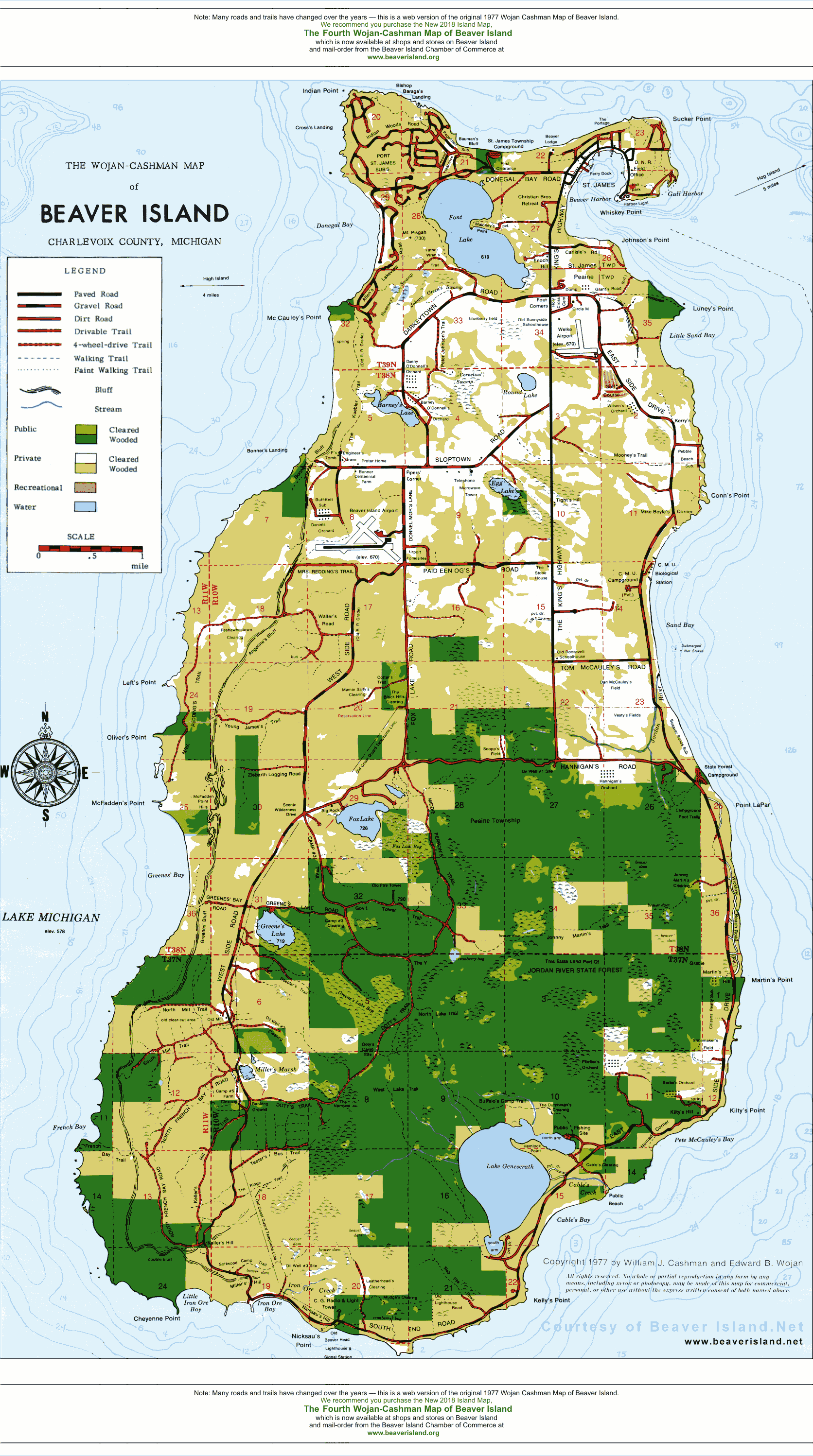
Copyright Note: You are most welcome to use and refer to this map for personal use, but you MAY NOT print it, copy it, or use it in any form for commercial purposes without prior written consent. NOTE:
On July 17, 2006 The Second Wojan-Cashman Map of Beaver Island will be available from Island merchants and from the Chamber of Commerce. The original Wojan-Cashman map (above) sold on the Island since 1977 - the new map features 29 years of road and trail updates, revised clearings, topography, new landmarks, a detailed legend of public access points, and much more. Please purchase this map in a high-quality 19" x 28" print (19 7/8" x 28 7/8" overall dimension) including shipping and handling form from the Beaver Island Chamber of Commerce. Also: BeaverIsland.Net also has the Beaver Island Historical Map on-line which is published by the Beaver Island Historical Society. Click here to view the 115k Historical Map. |