|
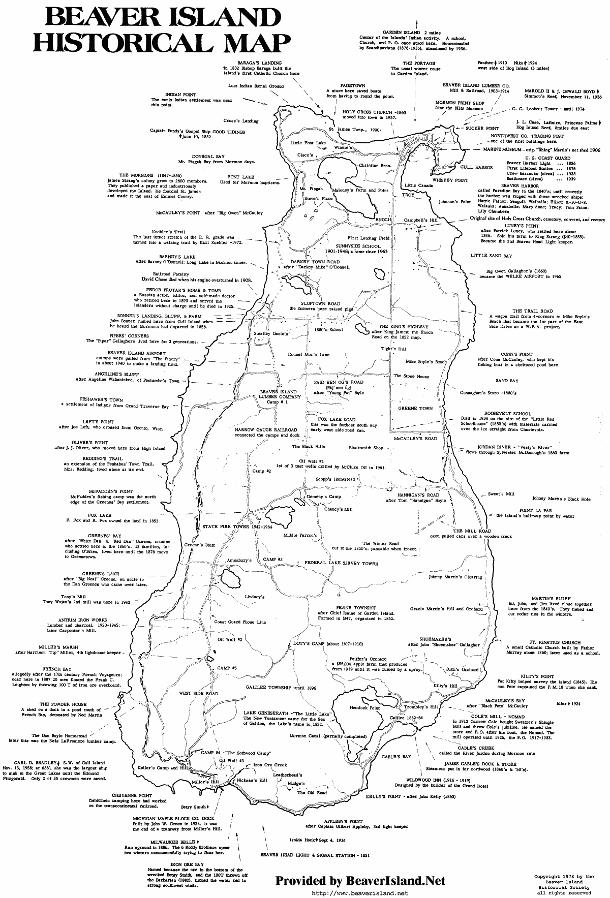
Beaver Island History Map | |||
 | |||
Click Here to open the larger 400k File. (This image is very large so it will take a moment to download on a slower connection but the text is easier to read) Click Here to open the 115k File. Copyright Note: The Map is Copyright 1978 by the Beaver Island Historical Society. You may use this map for personal use, but you MAY NOT print it, copy it, or use it in any form for commercial purposes without prior written consent. You MAY print one copy for your personal use. Click here if you need permission to use this map for other than personal use or if you want multiple copies. Also: BeaverIsland.Net also has a full Beaver Island Map on-line for your personal use. The file is 450k. Click Here to View the best Beaver Island Map | |||